


Portland City (Southeast) PUMA, Oregon
About
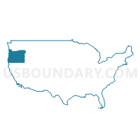
Outline
+PUMA%2c+Oregon_A280.png)
Summary
| Unique Area Identifier | 193830 |
| Name | Portland City (Southeast) PUMA |
| State | Oregon |
| Area (square miles) | 17.47 |
| Land Area (square miles) | 16.51 |
| Water Area (square miles) | 0.96 |
| % of Land Area | 94.49 |
| % of Water Area | 5.51 |
| Latitude of the Internal Point | 45.48237130 |
| Longtitude of the Internal Point | -122.61056270 |
Maps
+PUMA in Oregon.png)
Graphs
Select a template below for downloading or customizing gragh for Portland City (Southeast) PUMA, Oregon
+PUMA%2c+Oregon_T0.png)
+PUMA%2c+Oregon_T1.png)
+PUMA%2c+Oregon_T2.png)
+PUMA%2c+Oregon_T3.png)
+PUMA%2c+Oregon_T4.png)
+PUMA%2c+Oregon_T5.png)
+PUMA%2c+Oregon_T6.png)
+PUMA%2c+Oregon_T7.png)
+PUMA%2c+Oregon.png)
Neighbors
Neighoring Public Use Microdata Area (by Name) Neighboring Public Use Microdata Area on the Map
- Clackamas County (Northwest)--Oregon City, Milwaukie & Happy Valley Cities PUMA, OR
- Multnomah County (East)--Gresham & Troutdale Cities PUMA, OR
- Portland City (Central East) PUMA, OR
- Portland City (East) PUMA, OR
- Portland City (Northwest & Southwest) PUMA, OR
Top 10 Neighboring County (by Population) Neighboring County on the Map
Top 10 Neighboring County Subdivision (by Population) Neighboring County Subdivision on the Map
- Portland East CCD, Multnomah County, OR (462,994)
- Northwest Clackamas CCD, Clackamas County, OR (248,731)
- Portland West CCD, Multnomah County, OR (125,084)
Top 10 Neighboring Place (by Population) Neighboring Place on the Map
Top 10 Neighboring Unified School District (by Population) Neighboring Unified School District on the Map
- Portland School District 1J, OR (459,982)
- North Clackamas School District 12, OR (113,237)
- David Douglas School District 40, OR (63,567)
- Riverdale School District 51J, OR (2,831)
Top 10 Neighboring State Legislative District Lower Chamber (by Population) Neighboring State Legislative District Lower Chamber on the Map
- State House District 48, OR (76,579)
- State House District 47, OR (64,725)
- State House District 36, OR (63,722)
- State House District 51, OR (62,900)
- State House District 41, OR (59,890)
- State House District 46, OR (59,472)
- State House District 40, OR (59,417)
- State House District 42, OR (59,027)
- State House District 38, OR (58,003)
Top 10 Neighboring State Legislative District Upper Chamber (by Population) Neighboring State Legislative District Upper Chamber on the Map
- State Senate District 24, OR (141,304)
- State Senate District 18, OR (129,443)
- State Senate District 26, OR (126,141)
- State Senate District 20, OR (125,136)
- State Senate District 19, OR (121,745)
- State Senate District 21, OR (118,917)
- State Senate District 23, OR (118,187)
Top 10 Neighboring 111th Congressional District (by Population) Neighboring 111th Congressional District on the Map
- Congressional District 1, OR (802,570)
- Congressional District 3, OR (762,155)
- Congressional District 5, OR (757,128)
Top 10 Neighboring Census Tract (by Population) Neighboring Census Tract on the Map
- Census Tract 90, Multnomah County, OR (9,621)
- Census Tract 89.01, Multnomah County, OR (9,415)
- Census Tract 3.02, Multnomah County, OR (6,709)
- Census Tract 222.06, Clackamas County, OR (6,412)
- Census Tract 222.08, Clackamas County, OR (6,062)
- Census Tract 16.01, Multnomah County, OR (5,961)
- Census Tract 216.01, Clackamas County, OR (5,951)
- Census Tract 1, Multnomah County, OR (5,927)
- Census Tract 59, Multnomah County, OR (5,800)
- Census Tract 2, Multnomah County, OR (5,777)
Top 10 Neighboring 5-Digit ZIP Code Tabulation Area (by Population) Neighboring 5-Digit ZIP Code Tabulation Area on the Map
- 97206, OR (47,596)
- 97202, OR (38,762)
- 97219, OR (38,709)
- 97236, OR (36,852)
- 97222, OR (34,979)
- 97266, OR (33,300)
- 97086, OR (26,010)
- 97214, OR (23,813)
- 97215, OR (16,375)
- 97216, OR (15,594)